United Nations Convention on the Law of the Sea (UNCLOS)
Part II · Article 7 · Part III
Historical internal waters retain their own regime.
- Adoption
- Montego Bay, 10·Dec·1982
- CL ratification
- DS 1393, 25·Aug·1997
Fuente: https://www.un.org/Depts/los/
The Strait of Magellan is Chilean. This is the complete documentation of that sovereignty as of September 2026: international treaties, the legal framework in force, chain of title, sovereignty cartography, conflict history, and a catalog of the Chilean Armed Forces.
International treaties, the legal framework in force, the chain of title since 1520, and sovereignty cartography. The documentation that supports Chilean sovereignty.
Legal and historical documentation →History of conflicts, frustrated usurpations, and the Chilean military response since 1843. And the technical catalog of the Armed Forces as of Sept-2026.
Conflicts, doctrine and arsenal →The legal, historical and cartographic documentation that supports the Chilean sovereignty of the Strait of Magellan.
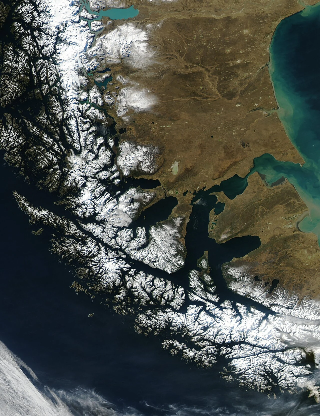
The Strait of Magellan is the principal natural passage between the Pacific and Atlantic oceans south of the American continent. It runs through the extreme south of Chile between parallels 52°30′S and 54°00′S, separating the continent from the Isla Grande de Tierra del Fuego. It is a navigable waterway of 611 km, with a minimum width of 3.1 km and depths between 30 m and more than 1,000 m.
Sources: SHOA, Atlas Marítimo de Chile, SHOA charts N.° 1, 4, 6, 7 and 8. The Magallanes Region has ~166,000 inhabitants (2026 INE projection); Punta Arenas is the regional capital on the northern shore of the Strait.
Part II · Article 7 · Part III
Historical internal waters retain their own regime.
Fuente: https://www.un.org/Depts/los/
Articles 1, 2 and 5
The Strait is forever neutralized and navigation is free to the flags of all nations.
Fuente: https://www.bcn.cl/leyes
Recast text DFL 1-19.522 (2000)
Fuente: https://www.bcn.cl/leyes
Vatican · Mediation of H.H. John Paul II
Fuente: https://www.bcn.cl/leyes
Four cartographic documents that illustrate the Chilean presence on the Strait from 1635 to the satellite era. The official historical cartography of Spain, Chile and SHOA documents the international recognition of the sovereignty.
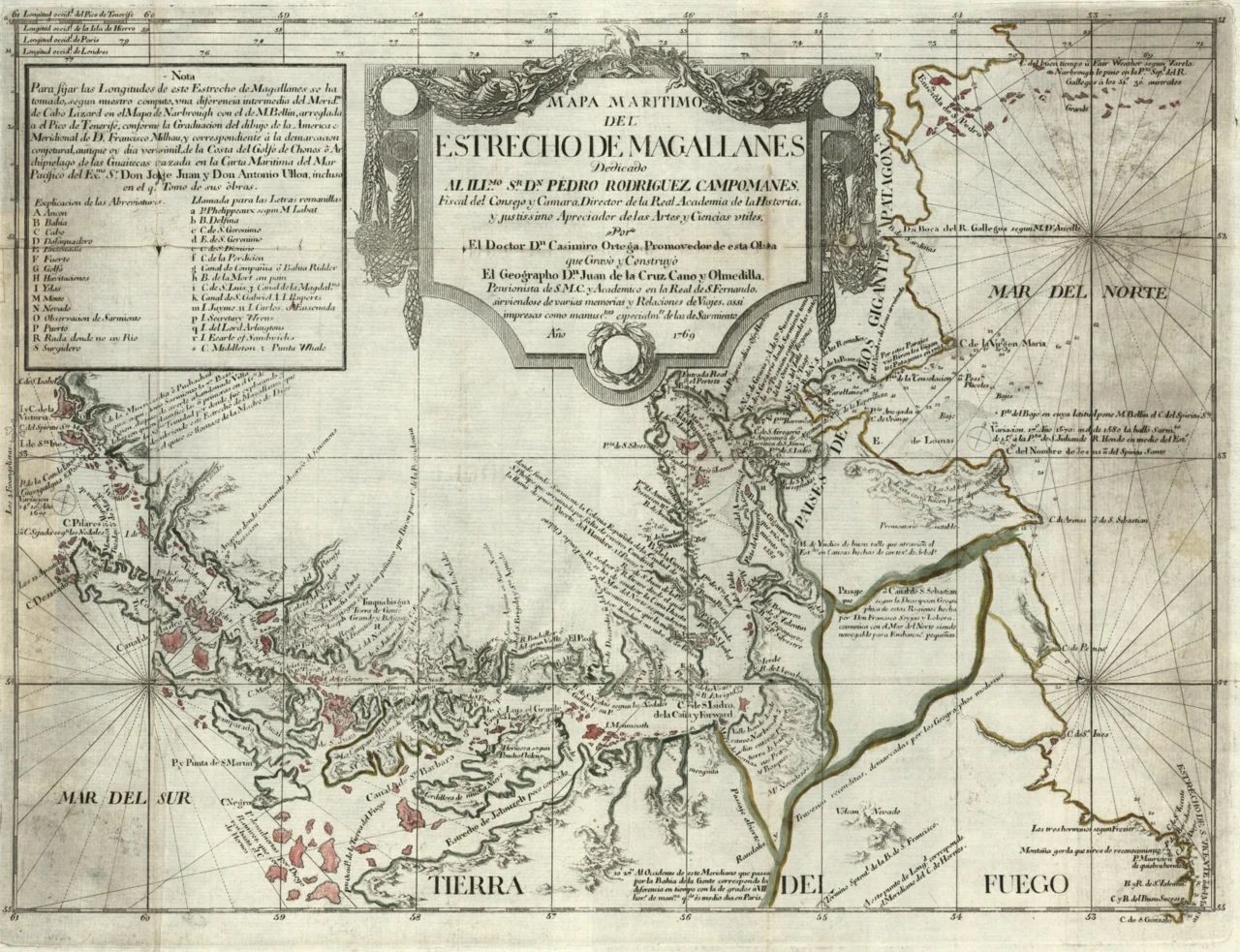
Official cartography of the Spanish Crown, made by Juan de la Cruz Cano y Olmedilla, Geographer of the Kingdoms of Spain.
Cano y Olmedilla, 1769 · 1769 · Wikimedia Commons · UAM · Licencia: Public domainThe history of conflicts, frustrated usurpations and the Chilean military response since 1843. With the technical catalog of the Armed Forces as of Sept-2026.
Documented chronology with verifiable sources of the acts of force carried out by the Argentine State against Chilean sovereignty in the austral space, between 1843 and 2026. Notarial tone, no war porn, no provocation.
Technical catalog of the fleet: 4 submarines, 8 frigates, 4 OPV-80, 1 oceanic icebreaker, ≈40 patrol vessels. Data verified against primary sources (armada.cl, EMCO).
Catalog of the ground force: ~186 Leopard 2A4 MBTs, infantry, artillery, special forces.
Catalog of the air force: 46 F-16, F-5, A-36, transport, helicopters.
Yes. The Strait of Magellan is internal waters of the Republic of Chile. Chile has exercised full sovereignty since 1843 under DFL 2.229/1978 and the bilateral treaties in force with Argentina.
Chile operates 4 submarines: 2 Scorpène with air-independent propulsion and 2 Type 209/1400-L, all based in Talcahuano.
46 F-16 fighters: 10 F-16C/D Block 50 (Cerro Moreno) + 36 F-16A/B MLU (Los Cóndores and Cerro Moreno).
A British court ruled in favor of Chile in 1977. Argentina rejected it. In 1978, the Argentine invasion plan "Operación Soberanía" was canceled by Vatican mediation of Card. Samoré and the Chilean mobilization. It was closed with the 1984 Treaty of Peace and Friendship.
Argentina's National Gendarmerie wounded and killed Lieutenant Hernán Merino Correa in a disputed sovereignty zone. He is the only Chilean officer killed by Argentine fire in a border zone in the 20th century.